Hans van der Kwast 
mastodon 4.7.3Associate Professor at #ihedelft | Owner of QWAST-GIS Consultancy & Training | Physical Geographer | #OpenSource advocacy | board member #qgisnl | #OSGeo Charter Member | #QGISHydro | #gisocw | #OpenData | #OpenEducation | #QGIS | #OSM | #Rotterdam | #PCRaster Tools plugin | #GroenLinksPvdA
I just passed 35K subscribers on my YouTube channel and I'm grateful for everyone following my open‑source geo work.
But for those who prefer to avoid big tech: my videos are also published on #QwastTube, my own #PeerTube instance.
▶️ QwastTube: https://videos.qwast-gis.com/
▶️ YouTube (if you still use it): @HansvanderKwast@www.youtube.com
#FOSS4G #OpenSource #PeerTube #DigitalSovereignty #QGIS #GIS #WebODM #PCRaster #RemoteSensing
Public sector #GIS users, your input matters!
The QGIS Trainer Network is running an international survey on how public institutions use and teach open‑source GIS. Results will be presented at the QGIS User Conference 2026 in Laax.
👉 Take the survey here: https://nx84716.your-storageshare.de/apps/forms/s/yZGamxYmwoSFcN9GmwymcBcs
🎉 New year, new #GIS skills!
⌨️ Learn scripting in #QGIS with my free course at @gisocw@fosstodon.org : no complex setup, just start from QGIS.
Topics:
#GDAL #CLI
#Python basics
#PyQGIS with the Notebook plugin ✨
👉 https://courses.gisopencourseware.org/course/view.php?id=80
The recording of Wednesday’s webinar “QGIS 4 for Water: What’s New, What’s Next?” is now available on the YouTube channel of the Australian Water School! With @geomenke@fosstodon.org, @yonas@mapstodon.space and myself.
📹 Watch it here: https://youtu.be/vnHxLHHz-ZQ
#QGIS #GIS #FOSS4G #OSGeo
All 60 videos from #QGIS for Hydrological Applications – 2nd Edition are now in the #Fediverse on #QwastTube! 🎉
Watch the full series here: https://videos.qwast-gis.com/c/qgishydro
Follow my video posts here:
@hansakwast@videos.qwast-gis.com
Follow the #QGISHydro channel here: @qgishydro
New video: train custom #deeplearning models without coding using the #QGIS Deepness plugin, #Roboflow & #Ultralytics.
Watch it on QwastTube: https://videos.qwast-gis.com/w/ucEzYZ8tSVCb9eDBRQUx4j
Vandaag staan @terglobo@mastodon.social en ik op de HAS #GeoExperience in 's-Hertogenbosch met een #QGIS‑stand. We geven ook een workshop over #pointcloud processing & #3D #visualisatie in QGIS.
Niet erbij? De workshop is gratis online te volgen op @gisocw@fosstodon.org: https://courses.gisopencourseware.org/course/view.php?id=82
Er staan nóg meer NL‑cursussen op GIS OpenCourseWare. Zie: https://courses.gisopencourseware.org/course/index.php?categoryid=8
#WebODM has officially split from #OpenDroneMap.
Official announcement from WebODM https://webodm.org/blog/announcement/
I made a short video showing the full workflow:
💻 Install WebODM with the new native installers
📸 import drone images
⚙️ process (orthomosaic, DSM, point cloud, 3D model)
🖼️ view in 2D/3D
⬇️ download results
🗺️ open in QGIS
If you want a user‑friendly, #opensource alternative to proprietary photogrammetry tools, WebODM is highly recommended.
🎥 Video: https://videos.qwast-gis.com/w/2KjiiJtEXEqz9qCSQnG5Ug
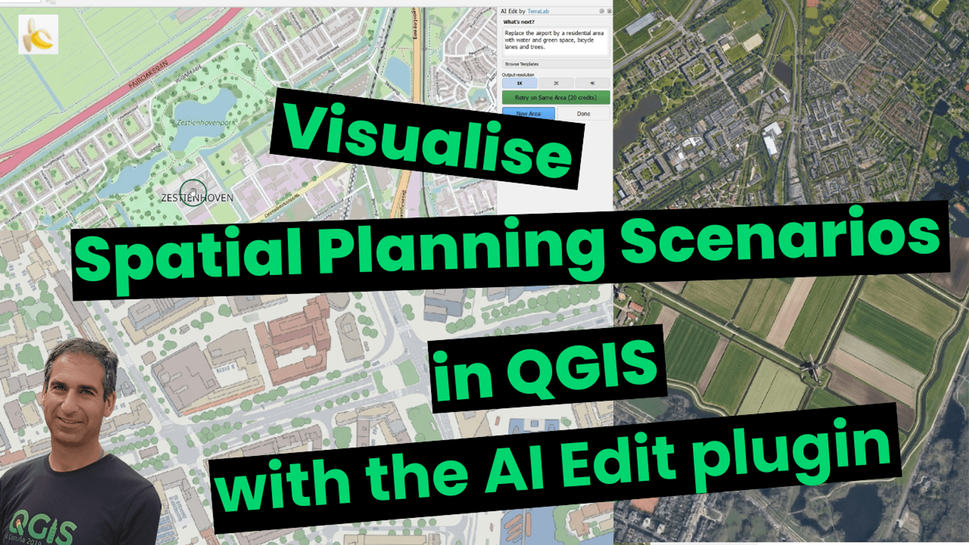
I’ve published a new video showing how the AI Edit plugin by #TerraLab can be used to visualise spatial planning scenarios in #QGIS.
From replacing an airport to simulating floods, adding green roofs, reopening canals, or generating a Dutch polder, it’s all there, with impressive visual results.
▶️ QwastTube: https://videos.qwast-gis.com/w/iUHsR4ceNzcP3d1B287sJ9
🗓Save the date: 8–9 juli!
Na 9 jaar keert #FOSS4GNL terug naar Groningen, waar het in 2017 begon.
Twee dagen vol #opensource geo: hands‑on workshops + een dag presentaties voor developers, toepassers, beheerders en beleidsmakers.
Samen met de @Jantina_Tammes_School@social.edu.nl bouwen @osgeonl@fosstodon.org en @qgisnl@mapstodon.space aan het programma & side‑events. Ideeën en helpende handen zijn welkom!
New open course at @gisocw@fosstodon.org! Learn collecting ground truth in the field with @merginmaps@fosstodon.org, #AI-assisted #segmentation of ground truth polygons with the AI Segmentation plugin by #TerraLab and the full workflow from downloading #Sentinel-2 data, Random Forest classification & accuracy assessment using the Semi-Automatic Classification plugin in #QGIS.
📢 Mergin Maps tutorial videos are now on #PeerTube!
If you use @merginmaps@fosstodon.org, the #opensource, field data collection tool built on #QGIS, you can now watch the video tutorials on #QwastTube:
🔗 https://videos.qwast-gis.com/c/merginmaps/videos?sort=-originallyPublishedAt
#Fediverse handle: @merginmaps@videos.qwast-gis.com
Great for anyone who values #digitalsovereignty and privacy‑respecting platforms!
Want to start a QGIS User Group or grow one? Join us this Friday for a #QGISOpenDay session with @qgis@fosstodon.org PSC Chair @mbernasocchi@fosstodon.org & @timlinux@fosstodon.org! Learn how to launch, run, and connect your group globally 🌍
📅 26 Sept 2025
🕚 11H00 UTC
📺 Livestream and more info: https://github.com/qgis/QGIS/wiki/QOD-September-2025
Let's add more
User Groups to the map!
#QGIS #OpenSourceGIS #CommunityBuilding #QGISOpenDay
#FOSS4GNL earlier this week in Wageningen was very inspiring. Great to see what the Dutch #opensource #geospatial community is doing. Nice to contribute with presentations and workshops. Read my blog for an impression: https://www.qwast-gis.com/l/foss4gnl-at-wageningen-campus/
@osgeonl@fosstodon.org @qgisnl@mapstodon.space #qgis @merginmaps@fosstodon.org
@osgeonl@fosstodon.org organiseert op 17 april een beginnersdag voor iedereen die met #opensource #geo wil starten. Ik geef daar een workshop over @merginmaps@fosstodon.org: in #QGIS een surveyproject opzetten en daarna buiten karteren met je telefoon.
📱🗺
Kom je ook? Programma en registratie: https://osgeo.nl/0_events/beginnersdag/
🚀 The new QGIS Certification Programme Website is live! Now it's easier to find certified training courses:
🗺 Use an interactive map to find certified training providers.
📅 Check out upcoming courses offering official QGIS certification.
🙏 Big thanks to Lova Andriarimalala, @timlinux@fosstodon.org & others for making this possible!
#30DayMapChallenge Day 5: Earth🌍
I mapped gas fields, mines & earthquakes in the Netherlands. #Groningen’s gas extraction and #Limburg’s mining caused seismic risks, which js now a political issue around damage & compensation. I made this while teaching #QGIS & @merginmaps@fosstodon.org in Leek (Groningen) for my company #QWAST, hired by #Fervent & #Geo2Meet. The course is part of a reskilling project for GIS jobs. #GIS
🚀 Today, I'm running a workshop on #PointCloud Processing in #QGIS at #FOSS4GEurope 2025 in #Mostar! We'll dive into:
🔹️ Downloading & preprocessing data
🔹️ Creating DSMs with interpolation
🔹️ 3D visualization & styling
🔹️ Elevation profiles & filtering
🔹️ Automation with #PDAL Wrench
🔹️ Editing point clouds
💻 Can’t join in person? Free access at @gisocw@fosstodon.org
🔗https://courses.gisopencourseware.org/
🎥 New video demonstrating the #QGIS Resources Hub portal and QGIS Hub plugin: https://youtu.be/79yFgVLvuZM
Improvements were made during the QGIS Contributor Meeting last week in Norrköping, Sweden. Thanks to @xpirix@mastodon.social, @ismailsunni@fosstodon.org & Ronit Jadhav!
Looking forward to see more contributions from the QGIS community to the hub! Styles, projects, models, layer files, Map Gallery & Processing Scripts—all making the hub a richer resource for geospatial innovation! 🚀
Taught #QGIS for groundwater applications to #ErasmusMundus #GroundwatCH MSc students last week at Instituto Superior Técnico in Lisbon. With inspiring guest lectures from @timlinux@fosstodon.org & alumna Namrata Karki. Students received the official QGIS certificate. #IHEDelft
Leaving Norrköping, Sweden, after an amazing #QGISUC2025! Some contributions during the Contributor Meeting:
🗺️ Added Map Gallery & Processing Scripts to #QGIS Hub web page (https://hub.qgis.org/)
🛠️ Fixed QGIS Hub plugin bugs w/ @ismailsunni@fosstodon.org @xpirix@mastodon.social & Ronit Jadhav
📢 Created geofenced news feed for FOSS4GNL w/ @terglobo@mastodon.social
📜 Reviewed QGIS Certification applications w/ @geomenke@fosstodon.org
🙌 This community is incredible! See you at @foss4geurope@fosstodon.org & next year in Switzerland!
🎙Last Saturday, I had a great chat with Safae Aala on the I.Talk podcast about my 25-year GIS journey. We covered QGIS, open source, education & innovation.
📺 Check it out here: https://youtu.be/_qhJezrsK-o
#QGIS #GIS #OSGeo
@Pepijn@mastodon.online is op pand niveau (BAG). Dit tabblad wordt nog niet gebruikt. Ik ben nog aan het uitzoeken wat volgens AVG mag. We houden geen namen, adressen etc. bij, alleen mogelijk atrributen per BAG pand.
Watch this interview with @burdGIS@mastodon.social about mapping #megafauna in #Maldives using @merginmaps@fosstodon.org.
With a nice demo and useful tricks! #QGIS https://youtu.be/dm6QBCWfiSk
Mergin Maps and Maldivian Megafauna - Demo on Data Collection for Environmental Studies
Don't forget to get your ticket for #FOSS4GNL!
📅 2 - 3 July
📍Wageningen
🔗https://foss4g.nl/
Workshops & talks in English and Dutch
@osgeonl@fosstodon.org @qgisnl@mapstodon.space
Today at #FOSS4GNL in Wageningen, I'm giving two workshops. If you can't make it to join the conference, you can follow along for free with the materials at @gisocw@fosstodon.org:
👉 Enhancing Crop Water Productivity with #WaPOR: A Hands-On Workshop Using #WaPlugin in #QGIS: https://courses.gisopencourseware.org/course/view.php?id=70
👉Mesh Data in QGIS: https://courses.gisopencourseware.org/course/view.php?id=72